The organization SWHO organizes different excursions which are included in the fees.
Hier einige Beispiele.... / Some examples:
Nationalpark "El Picacho" / National Park "El Picacho"
Der Nationalpark "El Picacho" bietet den Besuchern eine beeindruckende Aussicht auf die Hauptstadt Tegucigalpa. Es ist somit der ideale Ort, um Fotografien der Stadt zu machen. Der berühmte Christus Del Picacho, welcher jedem Ort der Stadt Tegucigalpa zu sehen ist, hat Aehnlichkieten mit dem Christus von Rio de Janeiro in Brasilien. Im Nationalpark befindet sich auch ein kleiner Zoo, wo gebürtige Tierarten Honduras anzutreffen sind. Dieser Park wurde am 2. August 1946 geöffnet. (Mehr Fotos im Post-Eintrag vom 23. August 2011)
The national park "el Picacho" offers an impressive view of the capital city Tegucigalpa to the visitors. It is the ideal place to take pictures of the city and to relax. Where ever you be in Tegucigalpa, “El Christo Picacho” can be seen. In the national park, there is a zoo with native species of Honduras. This park was opened on the 2nd of August 1946. (more pictures see post-entry 23. August 2011)
 |
| El Christo |
 |
| Aussicht auf Tegucigalpa |
Fotos aus dem Tierpark


Santa Lucía
Santa Lucía (auf Deutsch die Heilige Lucia) ist einer der ältesten Gemeinden von Honduras. Seine ersten Siedler waren einheimisch und haben diesen Ort mit dem Namen "Surcagua" getauft, den im Spanischem "Ort der Frösche" bedeutet. Es gibt Informationen dieses Ortes, welche bis ins Jahr 1500 nach Christus zurück gehen. Mit einer Höhe von ungefähr 1'500 Meter über Meer hat Santa Lucía ein fabelhaftes Klima. Santa Lucía, wie die Mehrheit von Bergbauvölkern der spanischen Kolonie, ist in den Bergabhängen der Berge gebaut, wo sich das Mineral befand. Santa Lucïa ist umgeben mit Kiefernwäldern.
Santa Lucía (in English the holy Lucia) is one of the oldest communities of Honduras. Its first settlers baptized this place with the name "Surcagua", in Spanish "place of the frogs" There is information of Santa Lucia which goes back to the year 1500. With a height of approximately 1'500 meter above sea level, Santa Lucía has a fabulous climate. Santa Lucía is constructed in the mountains where the minerals were found.


Im Inneren der Kirche kann das Bild von "Christus Señor der Gnaden von Santa Lucia" gesehen werden, zu welchem Santa Lucía im Jahre 1574 gekommen ist. Die Kirche ist normalerweise geschlossen, um seinen reichen künstlerischen kolonialen Inhalt zu schützen.


The church is normally closed in order to protect its rich artistic colonial art.
 |
| Strasse in Santa Lucía |
 |
| Pulperia (Kiosk) in Santa Lucía |
Valle de Angeles
Valle de Angeles (auf Deutsch: Tal der Engel) befindet sich 22 Kilometer von Tegucigalpa entfernt. Die Region war eine wichtige Minen-Stadt von Honduras. Dort wurden Gold, Silber, Kupfer, Zink, etc. produziert. Valle de Angeles ist bekannt für seine Kieferwälder, das typisch honduranische Essen sowie seine Handwerke. Das malerische Valle de Angeles ist der ideale Ort ist, um seine Käufe von Souvenirs zu verwirklichen und reine Luft einzuatmen.
Valle de Angeles (in English: Valley of the Angels) is located 22 kilometers from Tegucigalpa. The region was an important mining town in the history of Honduras, with enclaves such as Las Animas and El Socorro, which produced gold, silver, copper, tin, lead and zinc.
Tourist attractions are colonial architecture and farming, hiking trails, caving, ethnic crafts, contemporary art, ecotourism and its rainforest climate. In Valle de angeles you can enjoy the famous pupusas, "carne asada" (roasted meat) and delicious Honduran-style corn (corn with butter and cheese), but increasingly there are new restaurants to suit all tastes and palates. This town is visited by many tourists who enjoy the beautiful scenery. The road is completely paved from Tegucigalpa.
 |
| Strasse mit typischem Mototaxi |
 |
| Aussicht von einem typischen Restaurant auf den Parque Central |
Zamorano, die Schule "Agricola Panamericana" / Zamorano Pan-American Agricultural School
Die Landwirtschaftliche Panamerikanische Schule, bekannt als Zamorano liegt cirka 30 Kilometer von der Hauptstadt Tegucigalpa enternt. Der Bau der Schule wurde Ende des Jahres 1941 begonnen. Seither hat sich die Schule zur wichtigsten Universität in der Wissenschaft der Landwirtschaft und Viehzucht ganz Zentralamerikas entwickelt. Wegen seiner langen und vornehmen Tradition rechnet Zamorano in der Forschung von biologischen Wissenschaften hohes Ansehen in ganz Lateinamerikas.
The Zamorano Pan-American Agricultural School generally know as El Zamorano is a private, coeducational university. El Zamorano's main focus is agricultural and there are four different programs to choose from in the school. Zamorano is an international university that offers young people from different places and origins the opportunity to become professionals - disciplined and successful leaders - committed to the responsible management of natural resources, rural development and global competitiveness.
Under the motto of Learning-by-Doing, Zamorano has positioned itself as the only institution on a regional level capable of providing a university formation that combines theory, practice, character formation and leadership.
The university is located on a large campus of great natural beauty, colorful gardens and quite singular architecture. The entire property lies on some 70 km², including natural forests and two micro basins, large productive areas, many places for recreation and various buildings. There are green areas, paths and lagoons harboring numerous wild species that have found natural shelter on the Zamorano campus. The campus is home to more than 1000 resident students on the campus eleven months of every year. An area of 200,000 m² is set aside for student dorms.
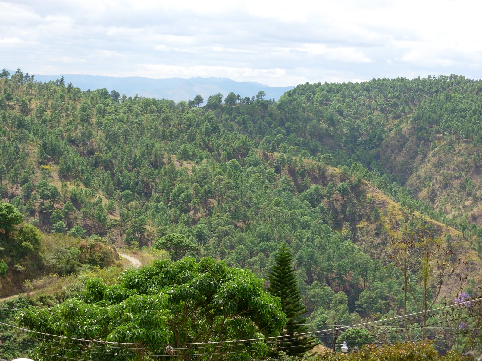
Nationalpark "La Tigra" / National Park "La Tigra"
Der Nationalpark "La Tigra" befindet sich im Nordwesten Tegucigalpas. "La Tigra" ist geschütztes Gebiet mit ungefähr 23,500 Hektaren tropischen Regenwaldes. Der gesetzliche Schutz besteht seit mehr als 40 Jahren. Der Nationalpark ist sehr wichtig im Bereich des Oekotourismus. Er versorgt ungefähr 30 % der Notwendigkeit an Trinkwassers in der Hauptstadt. In "La Tigra" können verschiedene Vogelarten beobachtet werden, welche ein anderen Teilen Honduras nicht zu sehen sind. Im Nationalpark La Tigra gibt es 8 Pfade, durch die die Besucher gehen und somit die Pflanzenwelt und die außerordentliche Tierwelt dieses Bergs genießen können. Der höchste lokale Punkt des Nationalparks liegt auf 2´290 Meter über Meer.
La Tigra National Park is close to the capital of Honduras. Its boundaries are a mere 14km from Tegucigalpa. La Tigra was initially established as a reserve in 1952 and then became Honduras’ very first national park in 1980. The park's boundary covers an area of approximately 23,571 hectares, with parts of La Tigra reaching altitudes of 2270 meters. Prior to the land being declared a protected area under Honduran law, large areas were deforested. The mining company in the area constructed a road through the cloud forest in order to connect Tegucigalpa and La Rosario. They cut down precious primary cloud forest trees for use in the mines. Despite the deforestation, La Tigra National Park still has an abundance of excellent features well worth exploring.
The high altitude of the park means that it is home to many areas of cloud forest, which is an ideal environment for oak trees to thrive. Cloud forests are forested areas covering mountaintops and contain an array of plant life, including lianas, vines, bromeliads, mosses and ferns.
In addition to being so close to a major city one of the main reasons for La Tigra’s popularity is because of its extensive and well-marked trail system, making the area readily accessible to visitors. The paths range in difficulty, with some paths being comfortable enough for families to walk with children, and then others for the more adventurous hiking explorer. La Tigra has six main trails and all of these can be managed without a guide, as long as visitors stick to the marked paths. La Cascada trail is 9.5km long and crosses from one entrance of the park to the other. On this route visitors can also enjoy a waterfall.


